Edwin Arthur Cade went to the Ashanti believing the mines were close to the coast and, therefore, they would be reasonably accessible. On his arrival, however, he learned they were not in the area currently under the British Protectorate and to reach them would not be easy as there were no roads beyond Prahsu – just paths through the forests.
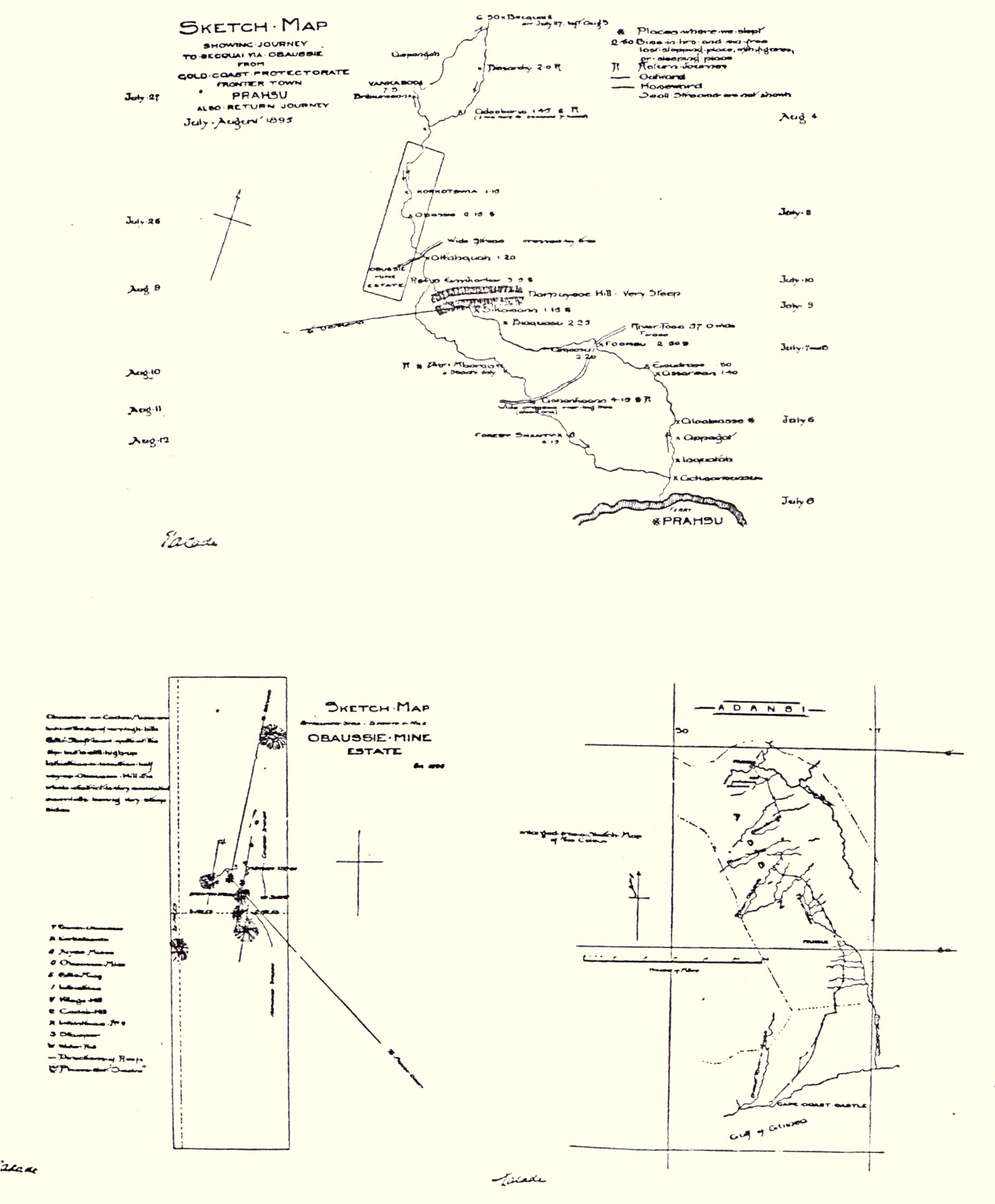
The journey was arduous but, finally, he and his group arrived. In documents that he wrote home to those who had invested in his trip, he describes it all in great detail; in order better to explain not only his trip but also the area in which the Concession was – and the difficulties of the enterprise, he sketched the maps below and wrote:
As no map, other than the Government sketch map, exists of this country, and no native, seemingly, has the remotest knowledge of geography or mileage or boundary (save rivers), it has been a most difficult matter to give even an approximate indication of the locality of the estate, or of our route, or even mileage, through the maze of the primeval forest; one cannot realise how difficult, until an idea is gained of what this dense forest is like, or what its ‘roads’ really imply, or the heat, labour, and endless hindrances and limitless turns which so constantly beset one’s path. For, such as it is worth, I submit a sketch map, which may give a more or less clear idea of where the estate is, and the way thereto. The true locality however, cannot be determined until a certain amount of clearing has been made on Obuassi Hill, and the readings of a sextant with an artificial horizon, etc, very carefully observed. I must admit the uncertainty of my calculation, for the sketch map referred to, places Bekwai quite 10 miles south of where I am persuaded it actually exists. If the Government be right however, then so much the better for us, in that the road would be so much the shorter from Prahsu.
The task of making our map fit in with the Government map is hopeless quite, unless Bekwai be moved as far to the east, then we begin to get near to our direction. One exceedingly awkward feature is the recurrence of places of the same name, in the same locality. I think best to let our route be shown just according to our calculations, and leave any reference to it as even approximately correct, to be decided in the manner suggested. In any case, there are many people now who know the roads to it well enough for all purposes of transport, etc, and they could always be used as guides for the direction of our route, whether that be direct, or very much otherwise, as we believe.
© VCRT